
GEOLOGY AND THE BEACHES |
|
|
|
|
|
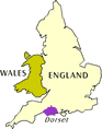
This area of Dorset is unique in the world. It contains a large number of different kinds of rock which end in the coastline. This means that the area contains some of the most varied and unique scenery and coastal features in the world in one small area. Geologists come from all over the world to study here since they can observe so many features in such a small area instead of having to travel hundreds of miles between features. For the tourist this means you have some of the best and varied scenery available in one place. Towards Weymouth at Osmington and Owermoinge the cliffs change to a clay which contains hundreds of fossil shells which can be picked up on the beach at low tide. The area between owermoinge and Weymouth offers a wide shingle beach (stones) and deeper water which is frequented by swimmer. Swimming is not really possible in Weymouth since the water is so shallow. The island of Portland, a giant piece of limestone, is joined to the mainland by an enormous bank of stones known as a tombolla, a geological feature that is very rare. This bank of stones known as Chesil bank is a wonder in itself. It stretches for 16 miles along the coast and is made entirely of stones. The stones have been graded by the seas so any part of the beach you visit will contain stones of all one size. The size of the stones increases as you go east. So the end of the bank at Burton Bradstock contains small stones about half an inch or less and these increase in size until the bank terminates at Portland cove where the stones are all about 7-8 inches across. You can walk up on the bank between Weymouth and Portland for wonderful views but be aware, however, that the bank is high and it's a hard climb if you are not used to it. Don't swim off Chesil bank, the undertow is very dangerous and will suck you back into the water. The stones make it hard to get in and out of the water. Also the profile of the bank changes from day to day depending on the sea. One day it can be one long gentle curve to the ocean (once you have climbed to the top) another it may be a series of steep banks with the last dropping precipitously into deep water. In this configuration in summer it is sometimes possible to stand on the edge and watch 8 foot mako sharks swim past only a couple yards from your feet! Chesil is most popular with fishermen due to the deep water and ease of casting a line from the bank. Sadly the fishing stocks have declined greatly over the last 15 years due to overfishing by European fleets which will sweep right up to the shore when the bank profile allows it. Chesil bank is backed by a large lagoon area known as The Fleet. This is a shallow salt water lagoon which is mainly mud and sand and an excellent nursery for many forms of marine life as well as birds and other animals. The only entrance the water has to the Fleet is at Ferry bridge in Weymouth harbour. This means that two tides occur in the fleet. When the tide goes out the water at the lower end of the Fleet flows out from the bridge and the shore is exposed. Then the water at the far end of the Fleet moves down and the tide appears to come in again as the water backs up trying to get out the narrow exit. The same happens on the tide's return. If you are in the area take care as the water moves in and out very quickly and it's easy to get cut off when the tide comes in. The cliffs from West Bay on to Lyme Regis and Seaton consist of clays and sands. They produce quite different scenery which is just as beautiful. The clays come in a range of colors and were once covered with a golden sandstone. Most of this material has now worn away and is now only visible at Golden Cap the highest point on the south coast. A wonderful view of this can been see from Charmouth. Because these cliffs are made of clay they are more unstable and tend to fall into the water. Don't walk on any newly fallen material it is extremely sticky and you will get stuck and not be able to get out. Many people have been caught and stranded by either walking on the falls or around them when the tide is out only to find they can't get back when the tide comes in. The far end of the county boasts the second largest natural harbour in the world - after Pearl Harbour in Hawaii. Unfortunately Poole Harbour is quite shallow for most of it's area and at low tide a lot of it is large expanses of mud flats. Much of the area is now off limits as a bird and wildlife santuary. The outer area on the eastern sides boasts Shell Bay one of the best and certainly the longest sandy beach in the county. (and in fact for several counties around). Shell bay is a remote area in a preserved coast (rather like a national park). There are no facilities to the beach and no houses, shops or the like in the area. It is day use only. It is also more difficult to get to. You can either drive to the end of the pennusula - the easiest way from most parts of the state, or take the ferry across from Poole. If you are staying in Poole a day trip on the ferry as a penestrian is often the best way to enjoy the beach.with only the beach. The harbour area is all mud as saltflats which are excellent for bird watching. You will need to check which areas are accessible as more and more are being closed to protect the wildlife from vandalization. |
 |
Contact us |
 |